Construction site
In the frame "Construction site" it is possible to define a boundary of inserted elements in the project (construction site boundary). In all cases the points of boundary have a same Z-axis coordiate as the nearest inserted element.
The program allows to enter three types of construction site boundary:
- Rectangle
The rectangle is defined by the limit coordinates (X, Y - axis). The default option in the program is "Generate rectangle automatically" - the limit coordinates are calculated automatically from the minimum and maximum coordinates of inserted elements.
Other option is to insert limit coordinates manually (<min, max> in the direction of X - axis, <min, max> in the direction of Y - axis)
- Convex hull
The program calculate automatically the smallest convex polygon for inserted elements.
- Defined polygon
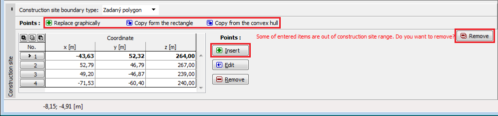
Input of closed polygon is required (button "Replace graphically"). This polygon defines boundary of construction side. Peaks of polygons can be made by new inserted points, originally specified points in the task or by their any combination.
The program allows to use points from existing rectangle or convex hull for creating new polygon (buttons: "Copy from the rectangle", "Copy from the convex hull"). After copying these points, it is possible to edit them (change coordiantes, add new points).
New point can be added just in the diialog window "New point" using the button "Insert".
It is also possible to edit inserted points by active dimensions.
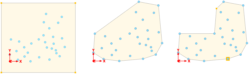 Construction site boundary type - rectangle, convex hull and entered polygon
If some elements stay out of the polygon (rectangle) boundary, the program shows the warning and user can delete these points using button "Remove". The elements out of the polygon are marked in red by default.
 Deleting elements out of the construction site
Visualization of drawing on the desktop can be modified in any input regime based on the setting adjusted in the "Drawing Settings" frame and with the help of buttons on the toolbar "Visualization".
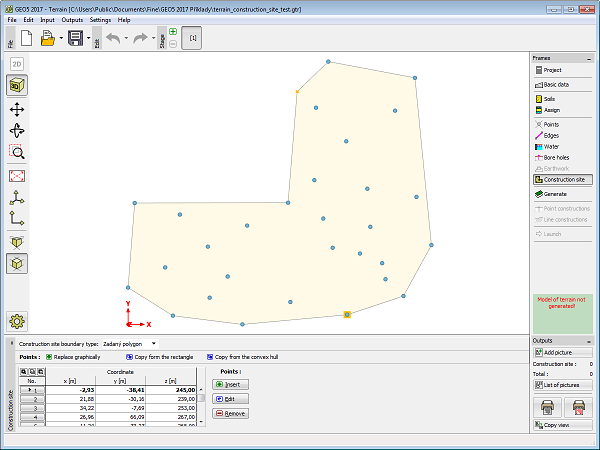 Frame "Construction site"